Showing posts with label coke. Show all posts

October 4, 2009

New Website About The Area - SWPA Rural Exploration


Crucible Ferry area


Levine Building Fire In Rices Landing and that site today
It's nice to welcome a new blog about our neck of the woods. Greene County native Chip Guesman has created a site he calls SWPA Rural Exploration and describes it this way " Exploring and photographing southwestern PA's abandoned mines, industry,homes....and whatever else we may find. A little history, a little legend..... from the most massive structures to the minute details we walk past every day."
He's only had the site going for a short time but there is already a lot of great photographs of things like the coke ovens at Poland Mines, and even a video of the area at Rices Landing where one can find the Stovepipe Ghost. Watch that video to actually see things come running out of the woods ! I felt like I was watching the Blair Witch Project :). Not for the faint hearted !
I am always fascinated with urban and rural archaeological websites and I'm very happy to see one dedicated to this area. I mean heck, we've got at least as much decaying infrastructure right here as one could hope to find anywhere else !


Rices Landing Low water 1980's, All images from SWPA Rural Exploration

September 22, 2009

On Coke Ovens and The Fayette County Exodus


Coke ovens at Poland Mines 2009 courtesy Of SWPA Rural Exploration

In the Ten Mile Creek area, Marianna, the Champion Mine at Besco, Dilworth at Rices Landing and Poland Mines # 2 all had coke ovens operating at one time or another. At most mines, a coking operation was set up as an adjunct to the mine, most mines producing more coal than they could process to coke. At Besco, with 257 ovens, the entire output was made to coke and shipped out that way. All coke ovens on this side of the river were of the beehive type as were the majority in western Pennsylvania. The later rectangular ovens were invented by W.J. Rainey engineers starting around 1905 and were adopted at a dozen larger works in the Connellsville and Klondike regions. This type was more mechanized and required higher labor skills. The final answer was using by-product ovens that captured all the gasses for use and brought the coking process to it's ultimate efficiency. This kind of operation was done best, not on site, but in large, dedicated works like the Clairton Coke Works, opened in 1918 and still the largest in the world. In the 1970's and 80's, the company I worked for, Ohio Barge Line, had at least 5 big boats moving coal from Kentucky to feed the ovens at Clairton, each boat bringing over 22,000 tons a week. There were dozens of other boats, all towing coal to there from out of the Mon, Allegheny and Ohio river mines.
By-product ovens outpaced beehive ovens by 1919 and eventually replaced the beehive ovens in the region by 1925, although some continued to operate as late as 1960.

Many older folks remember the way the nighttime sky would be lit up from the rows of ovens. I remember, as a child, seeing the glowing ovens of Alicia reflected on the river above Brownsville as we drove up the river road.


In the early decades of the last century as the new mines opened in Washington and Greene counties there was what I choose to call an exodus of sorts from the Fayette county mines. Many folks in the Ten Mile area can trace family roots back to Fayette county patch towns. Modern patch towns with indoor plumbing, electric lights, porches, general improvements to roads and grounds must have been part of the attraction as well as the idea of starting out a new life in a new place. Mather , Crucible, Richeyville and Marianna with their movie houses, ice cream parlors, ball fields and playgrounds, all built by the company, looked pretty good to these, many of them first generation Americans, coming from the old worn out patch towns to the east. Marianna's and Clarksville's ( Williamstown ) brick homes even had basements, unheard of in most older patches. Also, some of the older mines were being played out after many years of mining. Modern technology was already beginning to displace workers, more mechanized mining and coking meant the loss of many jobs. A lot of young men, miners already themselves, took the opportunity to strike out from the old family home to start a new life on their own in a new patch.


Map Courtesy Of coalcampusa.com

My Grandfather worked in Fayette for several years at East Millsboro for Hustead-Semens and moved to Clarksville in 1924 to finish his mining career in Clyde. All three of his sons became miners, two of them for their entire lives, my father in Clarksville and my Uncle George in Richeyville. My maternal grandfather worked in a lot of different mines. Arriving from the Tatra Mountains region of Poland in 1913, he, Thomas Krencik, went to work in a Fayette county mine and the next year sent money for boat passage for his wife and daughter. He and his wife Anna had 15 more children, four of which died in infancy. Of these, seven were born in Fayette county towns like Republic, Edenburg, Lambert and Helen. Around 1924 he moved his large family to Marianna, first to a farm and later to the patch. He wasn't finished roaming, by 1937 they were living in Ontario, near Cokeburg, from which mine he retired. By that time , several of his sons who took up mining had moved to Clarksville, Ellsworth, Marianna, Cokeburg and other area towns. Many of the older people that I have interviewed have direct ties to Fayette. Years of reading obituaries have shown me that if you come from this area and your roots go back to a couple generations of miners, odds are good that at least one side of your family came from the county to the east. In this way the already decades old commercial coal and coke industry in Fayette county significantly impacted on the later growth of the Ten Mile Creek area.

The 1850 US Census of Manufactures, the earliest Census reference to coke, listed Allegheny County as the only coke producer in the United States. By the 1860 Census, four counties in the United States that produced coke were listed. It should be noted that the Clinton furnace on Pittsburgh's Southside began using coke as its only fuel in 1859. By 1870 there were estimated to be 1,300 coke ovens in the United States. All of them were beehive ovens and all were in Western Pennsylvania, 1,063 in the Connellsville region alone. Of the 2,752,475 tons of coke produced in the US in 1880, Fayette Co. produced more than 45%. Westmoreland followed with 27%, and Allegheny contributed 3.5%. Combined, the three counties yielded almost 77% of the nation's total. In 1880 seventy-two percent of the nation's beehive ovens were within the same three counties. Connellsville coke was the unequaled fuel of preference for the iron and steel industry by 1890. The peak of Connellsville coke production was in 1916, when there were more than 40,000 active ovens.
Connellsville Coke Region Maps from National Park Service


April 8, 2009

Ten Mile Trivia # 2

Ten Mile Creek came to be called so because it's mouth is ten miles above Old Redstone Fort at Brownsville. In the early days they named creeks and other landmarks as being so many miles from a known place, as Brownsville certainly was in the early days. Islands also took mile marker names, for instance above Louisville Ky is 18 mile island then 12 mile island and then 6 mile island.
Some think the creek was named so because it's ten miles long. Not true, but ten miles up the creek is located the town of Ten Mile. Its Indian name is Cusuthee.
.
The very first steamboat to travel to New Orleans and return by its own power was the ENTERPRISE, designed and built in the Brownsville boatyards and launched from the Brownsville Wharf in 1814.

"Saint Barbara , the patron saint of miners, was a young virgin who defied her father and decided not to marry. Because of this he kept her in a tower. She ordered some workmen to alter the tower while her father was away, thus becoming the saint of architects. After finding out about this her father chased her to the hills where she was swallowed up by the hill. Her name is attached to Santa Barbara, California. There is a prayer for miners dedicated to Saint Barbara:
"As I now descend into the dark bowels of the earth, I beseech thee, sweet Barbara, that I be kept safe from harm, for it liketh me not that I rush unbidden into God's presence."

Wilson's Port, later called New Geneva was a very early place for freighting flatboats and rafts.The land later was patented by Elias Stone and his wife in 1787 and was called Delight.


Augustine Dillner and his wife were the first settlers in what is now Greene county.They arrived as early as 1754 and in 1755 built a cabin close to Crow's Ferry ( Dillner ). The Indians were friendly with them till Lord Dunmore's war of 1774.


"While making a tour of the United States in 1837, General Santa Anna, President of Mexico, stopped in Washington Pa.on January 15. Following the custom of the time, he probably took breakfast at Hill's Stone Tavern ( now the Century Inn ) in Scenery Hill, Pa. This was only a year after the massacre of the Texans at the battle of the Alamo, and Santa Anna was not very popular, so there was no reception committee. All known of this visit was the mere mention in the local paper, The Examiner of his passing and a well grounded tradition that a local man named Brice, whose brother had drawn a black bean ( died ) at Goliad, lay in wait just west of town to take a pot shot at the self styled "Napoleon of the West" as the stage rolled by. Fortunately for Santa Anna the sheriff heard of the plot, and, probably against his personal inclination, gathered Brice into his official fold until the Mexican was safely through Washington. Incidentally, Brice was a dead shot, and might have saved the United States much trouble nine years later if the sheriff had let him alone."

Hills Tavern now Century Inn


UMWA LOCALS
6330 Chartiers
688 Clyde
4583 Clarksville
6151 Mather
6290 Nemacolin
6310 Greensboro
4731 Crucible

6159 Bobtown
762 Vestaburg
2300 Waynesburg

UMWA Band of 4583 Clarksville Stanley Fowler Collection

One of the most notable early teachers in Fredericktown was Jonathan Knight. He was later one of the most eminent engineers of his day and became Chief Engineer of the Baltimore and Ohio railroad. He was the inventor of the coning of RR car wheels so that cars stationary on their axles can run on curved tracks without spreading the rails. He surveyed a line ( never built) for the B&O through Greene County in 1836. He lived in Centerville Pa.


Augustine Dillner and his wife were the first settlers in what is now Greene county.They arrived as early as 1754 and in 1755 built a cabin close to Crow's Ferry ( Dillner ). The Indians were friendly with them till Lord Dunmore's war of 1774.

In 1826 the Str. REINDEER was the first boat to Morgantown.

"On February 11, 1850, the first steamboat came up the Monongahela River to the little town of Fairmont. This boat was the GLOBE owned by a man named Yeager. Its appearance created a great sensation among the people, for the majority of them had never seen a steamboat, much less had one come up to their very doors. When it became known throughout the country that a steamboat was to come up the Monongahela River at daybreak on February 11, the people for miles around gathered along the banks of the river as early as the afternoon before. When the whistle of the Globe was heard down the river, the courthouse bell was rung for two hours. The people had brought lunches, so they took the day off as a holiday; speeches were made, and the new wonder examined. Many of the citizens had a free ride up the river. That day was long to be remembered." It was two years before another boat arrived.


In 1856 slackwater, meaning locks and dams, were completed up to New Geneva, making navigation possible nearly year round.

Dry Tavern was named so because in early days there was a tavern there with no liquor sold. It was on the main road leading south between Pittsburgh and Virginia. For years it was the busiest north - south road west of the mountains. The road was laid out by John Crawford and went from Pittsburgh to Finleyville, Bentleyville, Beallsville, Millsboro, Charmichaels, Willow Tree, Rosedale to Morgantown. It was planned to be 60 feet wide.

Ruff Creek got it's name from an Indian named Ruff who lived there.

The first telegraph line in Greene county was erected from Rices Landing to Waynesburg in 1861.


Southwest Pennsylvania was claimed by the districts of West Augusta, Virginia and by Westmoreland, Pennsylvania. In 1776 West Augusta became Ohio, Yohogania and Monongalia Counties, in Virginia. . Greene County in 1776 was partly ( the western slope ) in Ohio county Virginia and partly ( the eastern slope ) in Monongalia County Virginia. The court house for Monongalia was near New Geneva Pa. on the farm of Theopolis Phillips. The court house for Ohio county was at West Liberty W. Va. Virginia law directed that at each court house there was to be a pillory, a pair of stocks, a whipping post and a ducking stool ( now called waterboarding ). Only the ducking stool was used for women.
By 1780 Virginia and Pennsylvania settled their boundary dispute placing most of the Yohogania County region in Westmoreland County. In 1781 Washington County was created from Westmoreland County. Greene County was created from Washington County in 1796.


Before the big modern dams you could at times cross the mouth of Ten Mile Creek by skipping from rock to rock. Other times, because of the volume of water coming out of the creek a very large sand bar would build up there and the river channel would have to be dredged for boats to pass.

Besco is named for the Bessemer Coke Company who operated the Champion mine there using all the coal to make coke in it's 100 ovens . By 1914 there were 257 ovens, a sizable operation. The railroad reached Besco around 1911 and that was the end of track until it was extended farther through Clarksville to Mather in 1919.

In Common Pleas Court in 1797, the following case was considered : The Sheriff of Greene County wishes Richard Swan to answer the charge that he bit off a piece of John Moore's ear thereby damaging the peace and dignity of the Commonwealth.

November 22, 2008

East Millsboro

I think this town is certainly part of Ten Mile Country. This is the company store at East Millsboro around 1907. On the right is the Monongahela Railroad ticket and freight office and Adams Express Company. My father was born in in this town in 1912 where his father was a miner. Hustead - Semans Coal and Coke Co. was part of Fayette County's J. V. Thompson cartel. They started their mine at East Millsboro in 1903. A trade magazine in 1910 stated it was a slope mine with 8 1/2 feet thickness, was a machine and pick mine and had a daily capacity of 1000 tons. By 1905 the coke works had over 100 beehive ovens with 100 more planned. 150 Men were employed inside and out in 1913. In 1920 Hillman bought it, as they did so many other mines .


preceeding images collection of the author

A different view of the company store from a real photo post card dated 1911. That could likely be a mine animal in the foreground. Of interest is the free standing East Millsboro station sign in front of the building.


collection of Pittsburgh History And Landmarks

East Millsboro children enjoying the Hustead Mine river tipple. I like to think that one of those boys up there could be my father in his youth.These two piers remain at East Millsboro. Now both are in the river because of the raising of the pool due to Maxwell Lock.


image from Fredericktown Then And Now by Bower

A panoramic view of East Millsboro shows the Hustead Mine river tipple and the company store on the far right. This was taken around 1910-1915. Note the packet boat moving downriver at Millsboro.

November 21, 2008

Rice's Landing


The Str. I.C. WOODWARD, well known Mon River packet at the wharf in 1912

Old Lock #6 at Rices Landing. The original lock was completed in 1856. The Engineers did a major overhaul in 1902 and this image was made after that.


images collection of the author
This is where you will find the W. A. Young & Sons Foundry and Machine Shop. It is a real treasure in this area and everyone should visit it at least once. When I walked in there I felt as though I had just stepped out of a time machine. The W.A. Young Foundry has been called “the greatest find of its type in the nation” by the Smithsonian Institute’s curator emeritus. Built in 1900, this foundry and machine shop cast numerous items from horseshoes to locomotive wheels.

The Str. COLUMBIA downbound at Rices Landing.


Dilworth Mine Tipple at Rices Landing.

The Dilworth Mining Company (1880-1930) was the first major commercial coal mine in Greene County, It was a deep shaft mine and had 190 coke ovens and was located along the river on the northern border of Rice's Landing. Coal and coke were loaded directly into barges from the riverside mine.
In 1914, the Rice's Landing Coal and Coke Company acquired the Dilworth Mine. Within the next few years, the H.C. Frick Coke Company acquired the mine and many of the lots in Rice's Landing including two blocks between Second Street and the ferry landing.It was reopened in 1974 by U.S. Steel, and purchased by Consolidation Coal Co. in 1984.

This opens to a fine large map from Caldwells Atlas of 1876

List Of Business Rices Landing 1876


From The Monongahela Directory of 1859

John Swan tomahawked a claim in 1767 at what is now Rice's Landing. He, Jesse Vanmeter and Thomas Hughes built a fort about a mile south of Rice's Landing in 1768. The patent for the land above the run was given to John Rice and he laid out that part of the town as Newport grew. It was founded in 1780 when John Rice obtained a Virginia certificate for a 389-acre tract of land southeast of Pumpkin Run, then known as Enoch's Run. In 1786, Rice patented the land; and the town of Newport was laid out. Abijeah McClain and Pamela Doughty patented the lands to the northwest of the run where the town of Rice's Landing developed in the early 19th century. When the first post office was set up there it was given the name Rice's Landing. Until 1903, Rice's Landing and Newport remained as separate communities divided by the Cumberland and Jefferson Township line but connected by a covered bridge over Pumpkin Run. A later iron bridge was replaced in 1914 with the extant concrete deck bridge.
Even before improvements were made to the Monongahela River's navigation system, a prosperous packet trade operated on the river. By the 1830s, large keelboats and occasional steamboats docked at Rice's Landing where warehouse space provided storage facilities for goods. From the town's dock, Daniel Montgomery commanded a flatboat that was enrolled at the Pittsburgh Customs House in January of 1832. Joseph Sedgewick and his son, Samuel, were prominent traders who operated small steamboats on the Monongahela River when navigation conditions permitted. Sedgewick owned stores and warehouses at Rice's Landing. Unreliable seasonal navigation on the Monongahela River interfered with steamboat and keelboat travel until the improved canalization of the river by the Monongahela Navigation Company. When the locks were completed in November of 1856, a lock keeper was stationed at Rice's Landing to collect tolls. A ferry operated by the Hughes family crossed the Monongahela River at the north end of town providing access to Fayette County and Brownsville.

Rice's Landing was a key riverport on the Upper Monongahela River and served as the distribution point for all of northeastern Greene County including Waynesburg and Jefferson. By 1859 it was described as a "thriving settlement" owing "its present prosperity to the slackwater and its facilities as a shipping point. " The first telegraph line in Greene County, strung in 1861, ran from Rices Landing to Waynesburg.
During the era when it was a booming river town, lines of horse-drawn wagons and hacks would be strung out along the uphill road as far back as Dry Tavern, while the drivers awaited a turn to unload and reload. It was said that more business was transacted in Rices Landing in one day than transpired in Waynesburg in one week. Rices Landing flourished with two livery stables, cooper shops, blacksmith shops, boot stores, general stores, grist mill, planing mill, a machine shop, stone and pottery works, photo shop, sign painters, millinery shops, dress and hat shop, freight haulers, a greenhouse, a drugstore and three hotels. It is estimated that at one time there were 2,000 residents.


Monongahela House Hotel, undated, courtesy of Brad Kline
The Monongahela Hotel was for a many decades the trading and economic center of Greene and parts of Washington County. It was the place of choice for packet boat men, passengers, drummers (salesmen), traders and travelers of the era. The first floor of the old hotel, fronting on Main Street just opposite the U. S. River Lock No. 6, was for many years known as the Monongahela Commission House, where barrels of salt, sugar, flour were traded for hides, whisky, livestock, etc. Old ledgers kept by Linsey Hughes, a Commission House agent, reveals that almost all transactions were made by the barter system, with goods but not much money changing hands.
The famous lodging and trading place was built in 1840 by a group of influential citizens. Among those believed to have been part owners in the Monongahela House Corporation were Isiah Faddis, who was an early day hotel keeper, and Capt. J. Randolph Hewitt, a Civil War Veteran who operated a dry goods store in the building. In the early 1900's Capt. William Syphers owned the hotel. He also ran a small packet boat, the HAZEL L. WATSON between the town and Brownsville. The last owners were James Walton and Samuel Smith, who was an attorney in Waynesburg. In the fall of 1957 the 20-room, three story building, by then sagging and decrepit, was torn down. Only the steps still remain.


In 1870 local school teacher Isaac Hewitt, Jr. established the Excelsior Pottery Works where he produced gray salt-glazed stoneware distinguished by his "Rice's Landing" trademark. Hewitt's pottery was the most profitable company outside of the Greensboro and New Geneva stoneware center located upstream. The company annually produced 45,000 gallons and employed six workers who operated three wheels. Hewitt marketed part of his merchandise through agents while the remainder was sold from wagons by the proprietor. After a decade of success, production was reduced and the annual value dropped from $6,500 to only $2,000 in 1880. As navigation to the Greensboro and New Geneva pottery centers improved, Hewitt's pottery experienced competition for downriver trade, a factor that was most likely responsible for the pottery's demise around 1885. The pottery was later used as a residence and is still extant.

If you really know Rices Landing then you know just where to roll the car window down and yell " Stovepipe ."

This comment was left on a paranormal website discussing The Rices Landing Stovepipe ghost :
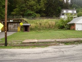
Train Tunnel Legend and locals claim on a rainy night a young boy in the 1800's was driving his horse and buggy over railroad tracks to take a short cut when the train came and collided with the buggy, the boy's head was severed and his body found a piece of stove pipe which it placed where his head would be, now on rainy nights after dark if you walk the tracks and call "Stove Pipe" three times his ghost will appear to you. Below is a follow up comment intended to correct the above statement:
The Stovepipe Ghost is not at the tunnel into Pumpkin Run Park. The train over that tunnel last ran in the 1930's, and nobody could drive a buggy over it because it was too narrow. There is a road called Horse Shoe Bend directly up from the tunnel. In the early 1900's a man was coming down Horse Shoe Bend in his horse & buggy when the buggy overturned and the mans head was cut off by the wheel of his wagon. When some men from town went to retrieve the body they said his neck was so flattened out that it resembled a stove pipe. About a year later, on the same road, a person was traveling by and thought he saw the headless body laying along side the road. Later the myth about Stovepipe began. If you go up Horseshoe Bend and stand at the 'bend' and say 'Stovepipe, Stovepipe, I found your head!' You can hear Stovepipe come up the embankment. The tunnel myth was started by some kids who have no knowledge of the town.
If you go under the tunnel and into Pumpkin Run Park and follow the road back then go across the creek, you will see a pile of cut stones. about 100 years ago there was a town back there called 'Casebear Hollow' and there was a stone quarry, a rock dust mill, as well as 10 houses. The stone quarry is a place where a lot of strange happenings have occurred. Its been said that sometimes you can hear eerie flute notes coming from near the quarry, and rumor has it that there is a flight of stairs that take you under the quarry and there are supposed to be some kind of evil things that live there. Further back in the park is a place called 'Mooney Rocks' where someone fell to their death from them. If you follow the creek you will eventually find yourself near the foundation of an old grist mill where the body of a murdered young girl was found....... How do I know these things? I've lived here for almost 65 years. Just be careful when you come here exploring."


There is a small general site about Rices Landing, I can recommend a page of theirs , one of nice and rare old photos, here.