Showing posts with label Dilworth. Show all posts

September 22, 2009

On Coke Ovens and The Fayette County Exodus


Coke ovens at Poland Mines 2009 courtesy Of SWPA Rural Exploration

In the Ten Mile Creek area, Marianna, the Champion Mine at Besco, Dilworth at Rices Landing and Poland Mines # 2 all had coke ovens operating at one time or another. At most mines, a coking operation was set up as an adjunct to the mine, most mines producing more coal than they could process to coke. At Besco, with 257 ovens, the entire output was made to coke and shipped out that way. All coke ovens on this side of the river were of the beehive type as were the majority in western Pennsylvania. The later rectangular ovens were invented by W.J. Rainey engineers starting around 1905 and were adopted at a dozen larger works in the Connellsville and Klondike regions. This type was more mechanized and required higher labor skills. The final answer was using by-product ovens that captured all the gasses for use and brought the coking process to it's ultimate efficiency. This kind of operation was done best, not on site, but in large, dedicated works like the Clairton Coke Works, opened in 1918 and still the largest in the world. In the 1970's and 80's, the company I worked for, Ohio Barge Line, had at least 5 big boats moving coal from Kentucky to feed the ovens at Clairton, each boat bringing over 22,000 tons a week. There were dozens of other boats, all towing coal to there from out of the Mon, Allegheny and Ohio river mines.
By-product ovens outpaced beehive ovens by 1919 and eventually replaced the beehive ovens in the region by 1925, although some continued to operate as late as 1960.

Many older folks remember the way the nighttime sky would be lit up from the rows of ovens. I remember, as a child, seeing the glowing ovens of Alicia reflected on the river above Brownsville as we drove up the river road.


In the early decades of the last century as the new mines opened in Washington and Greene counties there was what I choose to call an exodus of sorts from the Fayette county mines. Many folks in the Ten Mile area can trace family roots back to Fayette county patch towns. Modern patch towns with indoor plumbing, electric lights, porches, general improvements to roads and grounds must have been part of the attraction as well as the idea of starting out a new life in a new place. Mather , Crucible, Richeyville and Marianna with their movie houses, ice cream parlors, ball fields and playgrounds, all built by the company, looked pretty good to these, many of them first generation Americans, coming from the old worn out patch towns to the east. Marianna's and Clarksville's ( Williamstown ) brick homes even had basements, unheard of in most older patches. Also, some of the older mines were being played out after many years of mining. Modern technology was already beginning to displace workers, more mechanized mining and coking meant the loss of many jobs. A lot of young men, miners already themselves, took the opportunity to strike out from the old family home to start a new life on their own in a new patch.


Map Courtesy Of coalcampusa.com

My Grandfather worked in Fayette for several years at East Millsboro for Hustead-Semens and moved to Clarksville in 1924 to finish his mining career in Clyde. All three of his sons became miners, two of them for their entire lives, my father in Clarksville and my Uncle George in Richeyville. My maternal grandfather worked in a lot of different mines. Arriving from the Tatra Mountains region of Poland in 1913, he, Thomas Krencik, went to work in a Fayette county mine and the next year sent money for boat passage for his wife and daughter. He and his wife Anna had 15 more children, four of which died in infancy. Of these, seven were born in Fayette county towns like Republic, Edenburg, Lambert and Helen. Around 1924 he moved his large family to Marianna, first to a farm and later to the patch. He wasn't finished roaming, by 1937 they were living in Ontario, near Cokeburg, from which mine he retired. By that time , several of his sons who took up mining had moved to Clarksville, Ellsworth, Marianna, Cokeburg and other area towns. Many of the older people that I have interviewed have direct ties to Fayette. Years of reading obituaries have shown me that if you come from this area and your roots go back to a couple generations of miners, odds are good that at least one side of your family came from the county to the east. In this way the already decades old commercial coal and coke industry in Fayette county significantly impacted on the later growth of the Ten Mile Creek area.

The 1850 US Census of Manufactures, the earliest Census reference to coke, listed Allegheny County as the only coke producer in the United States. By the 1860 Census, four counties in the United States that produced coke were listed. It should be noted that the Clinton furnace on Pittsburgh's Southside began using coke as its only fuel in 1859. By 1870 there were estimated to be 1,300 coke ovens in the United States. All of them were beehive ovens and all were in Western Pennsylvania, 1,063 in the Connellsville region alone. Of the 2,752,475 tons of coke produced in the US in 1880, Fayette Co. produced more than 45%. Westmoreland followed with 27%, and Allegheny contributed 3.5%. Combined, the three counties yielded almost 77% of the nation's total. In 1880 seventy-two percent of the nation's beehive ovens were within the same three counties. Connellsville coke was the unequaled fuel of preference for the iron and steel industry by 1890. The peak of Connellsville coke production was in 1916, when there were more than 40,000 active ovens.
Connellsville Coke Region Maps from National Park Service


February 25, 2009

What's Under The Ground In Ten Mile Creek Country ?

These maps give one an idea of the condition of the the ground under us and the amazing extent of mining that's gone on here. The earliest of the mines shown here were worked starting around 80 some years preceding the late 70's when this map was made. All these open to large size.


There are only a few above ground reference points shown but I think there are enough to orient one as to what is seen.


Mather Collieries, solid line at right points north. They did not mine north of the town but to the south the mine went almost to State Route 21.


This shows the area from the river roughly south to Charmichaels

maps from collection of author

February 23, 2009

Steamboat To Clarksville and Other Boats On Ten Mile Creek

There are a few documented instances of steamboats on Ten Mile Creek. The month of July in the year 1888 saw what was one of the biggest floods ever on the Monongahela. At Brownsville in that year the river crested at 43 feet, the all-time high water mark there. This was three feet more than even the great flood of 1936. On the crest of this 1888 flood the sternwheel towboat WILLIAM WAGNER ran up Ten Mile Creek and landed at Clarksville. The boat was built at Pittsburgh in 1882 and was 100 x 17 x 2 feet. This was a good sized boat, much bigger than the few steam yacht / pleasure boats that are known to have travelled up our creek. There would have been no bridges to deal with at that time until they reached Clarksville, a little less than three miles from the river. Judging by the configuration of the creek it must have been some hard shoving once up to the area where Pitt Gas and Besco would later be. The vessel was owned By Capt. J. C. Cooper ( called Clinton by his friends ) and Levi Barker. Capt Cooper was in command on this trip. What business they had there, if they had a barge in tow or where at the town they landed is unknown. At that time some towboats running in backwater trades also carried a limited number of passengers, even a small 60 foot boat could be registered for 5 cabin and 5 deck passengers. It is possible too, that they did it just for bragging rights as that was sometimes done by these early rivermen. According To Capt. Way's Steam Towboat Directory the boat was " principally remembered as towing timber out of the Upper Monongahela to boatyards and elsewhere." She was out of documentation ( no longer operating ) in 1890. No photographs of her exist. Capt. Cooper's daughter, Mrs. Phil Kussart, is the author of a river history book titled " The Allegheny River . "

Another boat that visited Clarksville on a flood was the little steam propeller yacht GAZELLE. Nothing is known of either her business or the year she went up. She was 65 x 10 x 3 and built by R. C. Price at Allegheny ( now the North Side of Pittsburgh ) Pa. in 1901. At that time she was owned By Harrison P. Dilworth and other Greene County businessmen who had coal properties on the upper Monongahela. On the trip to Clarksville she was under the command of Capt. John S. Faddis who was, I believe, from the Rices Landing area. He was a riverman of some versatility. In 1905 Capt. Faddis was Master of the ROSE HITE, a large ( 155 x 28 x 4 ) Mon river packet boat that ran the upper Mon. He was at the wheel when she collided with the towboat JOHN F. KUEN above Brownsville and sank with the loss of 5 Black deckhands. He also ran the small DAISEY, a " daylight short trader " , between Martin Pa. and Morgantown early in the century. She was a little sternwheel packet , 75 x 14 x 2 with one boiler that was 54" x 7 feet, built at Antiquity Pa. in 1903. Originally built by Capt. E. E. Varian, she was later owned by H.E. and T. B. Eberhart. In 1908 she was sold to Capt. William Goudy of Rices landing and in 1911 she was sold down the Ohio River. No photo known to me exists of this boat. The GAZELLE probably looked somewhat like the HAZEL L. WATSON in the picture below.


This photo shows the little propeller steamer HAZEL L. WATSON running between East Millsboro and Millsboro with the Mouth of Ten Mile Creek in the background. This photo was taken after 1907 since we see the RR bridge across the creek's mouth. This is an old real photo post card view that I bought years ago and likely one of a kind as those often are. The writer of this card describes it as "the ferry", more accurate would be the old term packet boat or the modern term water taxi. It is likely to assume that she made occasional trips into Ten Mile, water permitting. She was built at Allegheny Pa. in 1901 and was 70 x 10 x 3. Owned by Capt. John O. Watson in 1907, Capt. William Syphers of Rices landing bought part interest and owned her outright by 1909. Syphers, who owned the Monongahela Hotel in Rices Landing, ran her between Brownsville and Rices Landing. Later owned by Crosan Construction of Brownsville , she was lost on Feb. 10, 1918 in the big ice of that year , at Rices Landing.
Ten Mile Creek did, and still does put out quite a volume of water. In old times before the new locks a bar would build up running across the river at the creek's mouth and had to be regularly dredged so that boat traffic could pass up and down.

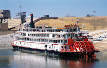
One more steamboat that has a direct connection to Ten Mile is the CLAIRTON. She was built at Ambridge Pa. in 1927 and was 147 x 33 x 6. Originally the called YOUGHIOGENY for Carnegie Steel she was later named the B. F. FAIRLESS. She came to be called CLAIRTON in 1952, being the third and last boat of that name. She ran almost entirely on the Mon till 1964 and was laid up at / near Engles Boat Docks at the mouth of the creek at Millsboro. There was hope she could be utilized locally as a museum but this never came about. While she was laid up there she had a new career as a restaurant for several years. With my family I took a few meals on that old boat . I remember that it was none too fancy but quite clean, everything wood painted white, inside and out. Guests had to ascend to the boiler ( second ) deck for seating in a small saloon. I prowled around her several times on those visits and I fail to remember her having her wheel , it may have been removed. A final chapter to the story is that in 1974 she was sold to a New Orleans company. Her engines , less boilers, were installed in the NATCHEZ, a sternwheel steamboat built new in 1975 for the day excursion trade and those same engines power her in New Orleans Harbor to this day, every day. Some old boats never die.


The CLAIRTON when she was still the B. F. FAIRLESS at the Elizabeth bridge in 1950, shoving coal as she did for 37 years.

November 21, 2008

Rice's Landing


The Str. I.C. WOODWARD, well known Mon River packet at the wharf in 1912

Old Lock #6 at Rices Landing. The original lock was completed in 1856. The Engineers did a major overhaul in 1902 and this image was made after that.


images collection of the author
This is where you will find the W. A. Young & Sons Foundry and Machine Shop. It is a real treasure in this area and everyone should visit it at least once. When I walked in there I felt as though I had just stepped out of a time machine. The W.A. Young Foundry has been called “the greatest find of its type in the nation” by the Smithsonian Institute’s curator emeritus. Built in 1900, this foundry and machine shop cast numerous items from horseshoes to locomotive wheels.

The Str. COLUMBIA downbound at Rices Landing.


Dilworth Mine Tipple at Rices Landing.

The Dilworth Mining Company (1880-1930) was the first major commercial coal mine in Greene County, It was a deep shaft mine and had 190 coke ovens and was located along the river on the northern border of Rice's Landing. Coal and coke were loaded directly into barges from the riverside mine.
In 1914, the Rice's Landing Coal and Coke Company acquired the Dilworth Mine. Within the next few years, the H.C. Frick Coke Company acquired the mine and many of the lots in Rice's Landing including two blocks between Second Street and the ferry landing.It was reopened in 1974 by U.S. Steel, and purchased by Consolidation Coal Co. in 1984.

This opens to a fine large map from Caldwells Atlas of 1876

List Of Business Rices Landing 1876


From The Monongahela Directory of 1859

John Swan tomahawked a claim in 1767 at what is now Rice's Landing. He, Jesse Vanmeter and Thomas Hughes built a fort about a mile south of Rice's Landing in 1768. The patent for the land above the run was given to John Rice and he laid out that part of the town as Newport grew. It was founded in 1780 when John Rice obtained a Virginia certificate for a 389-acre tract of land southeast of Pumpkin Run, then known as Enoch's Run. In 1786, Rice patented the land; and the town of Newport was laid out. Abijeah McClain and Pamela Doughty patented the lands to the northwest of the run where the town of Rice's Landing developed in the early 19th century. When the first post office was set up there it was given the name Rice's Landing. Until 1903, Rice's Landing and Newport remained as separate communities divided by the Cumberland and Jefferson Township line but connected by a covered bridge over Pumpkin Run. A later iron bridge was replaced in 1914 with the extant concrete deck bridge.
Even before improvements were made to the Monongahela River's navigation system, a prosperous packet trade operated on the river. By the 1830s, large keelboats and occasional steamboats docked at Rice's Landing where warehouse space provided storage facilities for goods. From the town's dock, Daniel Montgomery commanded a flatboat that was enrolled at the Pittsburgh Customs House in January of 1832. Joseph Sedgewick and his son, Samuel, were prominent traders who operated small steamboats on the Monongahela River when navigation conditions permitted. Sedgewick owned stores and warehouses at Rice's Landing. Unreliable seasonal navigation on the Monongahela River interfered with steamboat and keelboat travel until the improved canalization of the river by the Monongahela Navigation Company. When the locks were completed in November of 1856, a lock keeper was stationed at Rice's Landing to collect tolls. A ferry operated by the Hughes family crossed the Monongahela River at the north end of town providing access to Fayette County and Brownsville.

Rice's Landing was a key riverport on the Upper Monongahela River and served as the distribution point for all of northeastern Greene County including Waynesburg and Jefferson. By 1859 it was described as a "thriving settlement" owing "its present prosperity to the slackwater and its facilities as a shipping point. " The first telegraph line in Greene County, strung in 1861, ran from Rices Landing to Waynesburg.
During the era when it was a booming river town, lines of horse-drawn wagons and hacks would be strung out along the uphill road as far back as Dry Tavern, while the drivers awaited a turn to unload and reload. It was said that more business was transacted in Rices Landing in one day than transpired in Waynesburg in one week. Rices Landing flourished with two livery stables, cooper shops, blacksmith shops, boot stores, general stores, grist mill, planing mill, a machine shop, stone and pottery works, photo shop, sign painters, millinery shops, dress and hat shop, freight haulers, a greenhouse, a drugstore and three hotels. It is estimated that at one time there were 2,000 residents.


Monongahela House Hotel, undated, courtesy of Brad Kline
The Monongahela Hotel was for a many decades the trading and economic center of Greene and parts of Washington County. It was the place of choice for packet boat men, passengers, drummers (salesmen), traders and travelers of the era. The first floor of the old hotel, fronting on Main Street just opposite the U. S. River Lock No. 6, was for many years known as the Monongahela Commission House, where barrels of salt, sugar, flour were traded for hides, whisky, livestock, etc. Old ledgers kept by Linsey Hughes, a Commission House agent, reveals that almost all transactions were made by the barter system, with goods but not much money changing hands.
The famous lodging and trading place was built in 1840 by a group of influential citizens. Among those believed to have been part owners in the Monongahela House Corporation were Isiah Faddis, who was an early day hotel keeper, and Capt. J. Randolph Hewitt, a Civil War Veteran who operated a dry goods store in the building. In the early 1900's Capt. William Syphers owned the hotel. He also ran a small packet boat, the HAZEL L. WATSON between the town and Brownsville. The last owners were James Walton and Samuel Smith, who was an attorney in Waynesburg. In the fall of 1957 the 20-room, three story building, by then sagging and decrepit, was torn down. Only the steps still remain.


In 1870 local school teacher Isaac Hewitt, Jr. established the Excelsior Pottery Works where he produced gray salt-glazed stoneware distinguished by his "Rice's Landing" trademark. Hewitt's pottery was the most profitable company outside of the Greensboro and New Geneva stoneware center located upstream. The company annually produced 45,000 gallons and employed six workers who operated three wheels. Hewitt marketed part of his merchandise through agents while the remainder was sold from wagons by the proprietor. After a decade of success, production was reduced and the annual value dropped from $6,500 to only $2,000 in 1880. As navigation to the Greensboro and New Geneva pottery centers improved, Hewitt's pottery experienced competition for downriver trade, a factor that was most likely responsible for the pottery's demise around 1885. The pottery was later used as a residence and is still extant.

If you really know Rices Landing then you know just where to roll the car window down and yell " Stovepipe ."

This comment was left on a paranormal website discussing The Rices Landing Stovepipe ghost :
Train Tunnel Legend and locals claim on a rainy night a young boy in the 1800's was driving his horse and buggy over railroad tracks to take a short cut when the train came and collided with the buggy, the boy's head was severed and his body found a piece of stove pipe which it placed where his head would be, now on rainy nights after dark if you walk the tracks and call "Stove Pipe" three times his ghost will appear to you. Below is a follow up comment intended to correct the above statement:
The Stovepipe Ghost is not at the tunnel into Pumpkin Run Park. The train over that tunnel last ran in the 1930's, and nobody could drive a buggy over it because it was too narrow. There is a road called Horse Shoe Bend directly up from the tunnel. In the early 1900's a man was coming down Horse Shoe Bend in his horse & buggy when the buggy overturned and the mans head was cut off by the wheel of his wagon. When some men from town went to retrieve the body they said his neck was so flattened out that it resembled a stove pipe. About a year later, on the same road, a person was traveling by and thought he saw the headless body laying along side the road. Later the myth about Stovepipe began. If you go up Horseshoe Bend and stand at the 'bend' and say 'Stovepipe, Stovepipe, I found your head!' You can hear Stovepipe come up the embankment. The tunnel myth was started by some kids who have no knowledge of the town.
If you go under the tunnel and into Pumpkin Run Park and follow the road back then go across the creek, you will see a pile of cut stones. about 100 years ago there was a town back there called 'Casebear Hollow' and there was a stone quarry, a rock dust mill, as well as 10 houses. The stone quarry is a place where a lot of strange happenings have occurred. Its been said that sometimes you can hear eerie flute notes coming from near the quarry, and rumor has it that there is a flight of stairs that take you under the quarry and there are supposed to be some kind of evil things that live there. Further back in the park is a place called 'Mooney Rocks' where someone fell to their death from them. If you follow the creek you will eventually find yourself near the foundation of an old grist mill where the body of a murdered young girl was found....... How do I know these things? I've lived here for almost 65 years. Just be careful when you come here exploring."


There is a small general site about Rices Landing, I can recommend a page of theirs , one of nice and rare old photos, here.